







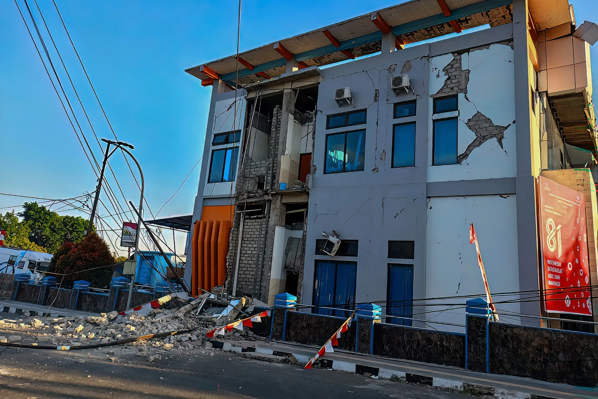
MAUMERE, Indonesia (AP) — A powerful magnitude 7.7 earthquake struck off the coast of Indonesia early Saturday, damaging buildings and homes, and triggering a tsunami warning. There were no immediate reports of casualties.
Read more Two of San Diego’s roughest freeway underpasses are getting new murals
The U.S Geological Survey said the quake hit Indonesia’s Flores region with a depth of 10 kilometers at 5:58 a.m. Indonesia time. Its epicenter was 42 miles north-northwest of the city of Ende in East Nusa Tenggara province.
The initial quake was followed by several aftershocks.
Indonesia’s Meteorology, Climatology and Geophysics Agency issued a tsunami warning for part of East Nusa Tenggara, West Nusa Tenggara, South Sulawesi and Southeast Sulawesi provinces, and urged residents to stay away from beaches and riverbanks. The agency located the shallow undersea quake near Flores island. Residents along affected coastlines were advised to move to higher ground as officials were closely monitoring coastal tide gauges for any changes.
The quake was felt across much of Flores Island. Initial reports indicated there was damage to homes and public facilities, though officials had not yet released estimates of the number of damaged buildings or any casualties.
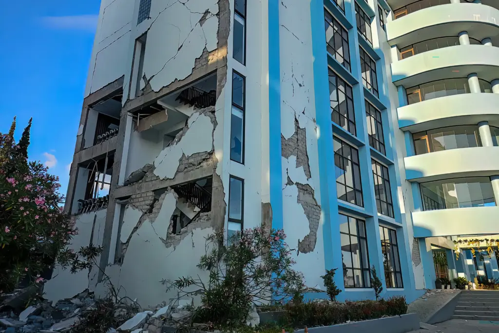 A damaged building is seen following a 7.0-magnitude earthquake in Ruteng, Manggarai, East Nusa Tenggara, on August 15, 2026. A strong 7.7-magnitude earthquake struck off Flores island in eastern Indonesia early on August 15, the US Geological Survey and Indonesian authorities said, triggering a tsunami warning and prompting hundreds to evacuate. (Photo by SELO / AFP via Getty Images)
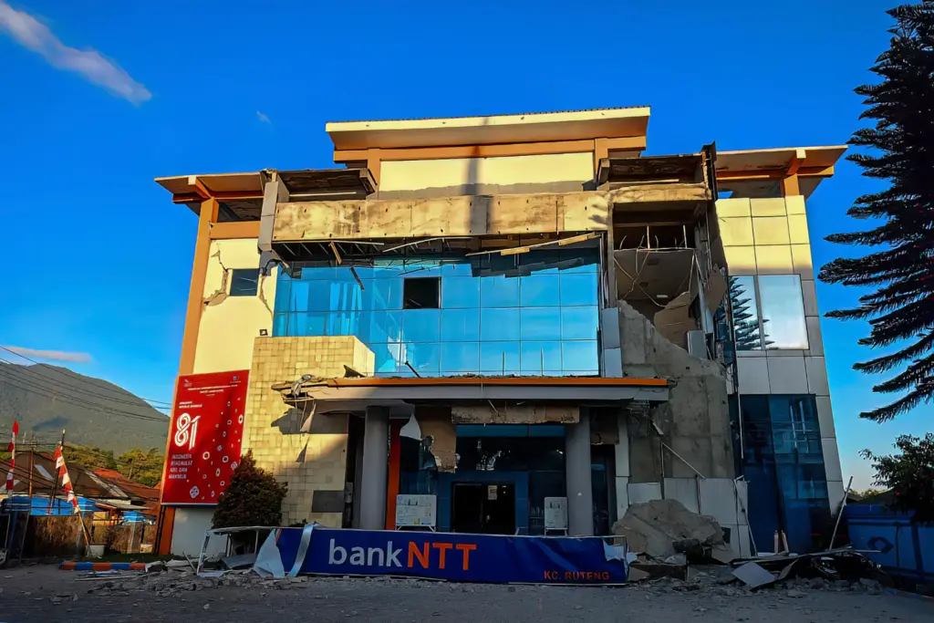 A damaged building is seen following a 7.0-magnitude earthquake in Ruteng, Manggarai, East Nusa Tenggara, on August 15, 2026. A strong 7.7-magnitude earthquake struck off Flores island in eastern Indonesia early on August 15, the US Geological Survey and Indonesian authorities said, triggering a tsunami warning and prompting hundreds to evacuate. (Photo by SELO / AFP via Getty Images)
Yohanna Embu, a resident of Sikka, a regency within East Nusa Tenggara province, said a number of buildings were damaged by the strong shaking and panicked people ran to higher ground.
Read more Man dies after being found unresponsive in San Diego jail
“Many buildings here were damaged … I saw that the waiting room at the Pelni port terminal in Maumere had collapsed,” she said.
Indonesia, a vast archipelago of more than 17,000 islands, is prone to earthquakes and volcanic activity because of its location on the “Ring of Fire,” an arc of volcanoes and fault lines in the Pacific Basin.
It’s the second time the country has been hit by a major earthquake this summer. A 6.7 magnitude earthquake struck Palu, Central Sulawesi, on June 16, 2026.
In December of 1992, a magnitude 7 earthquake caused a tsunami that killed about 2,500 people on the southeastern island of Flores, part of a group of islands in the eastern half of Indonesia.